Archive | August, 2012

Float #49 – 51: Current River

31 Aug

Powder Mill to Big Spring

Current River
Shannon & Carter Counties, Missouri
Friday, August 17 – Sunday, August 19
30 miles

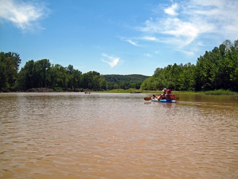
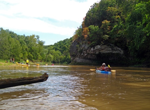
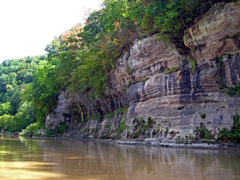
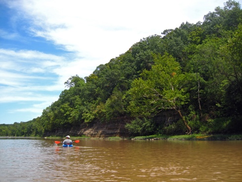
I had been looking forward to this float for weeks and it did not disappoint. This section of the Current is one of my favorites for the beauty of the landscape, the lack of other boaters and the excellent fishing. Two of our best friends who used to live in Missouri joined us for this trip. Jake drove up from Nashville and Aaron flew in from NYC. On Friday morning we loaded the car with 3 kayaks, the canoe and lots of dry bags. We met up at Powder Mill access (also known as Owl’s Bend). Jake and DW ran the shuttle down to Van Buren while Aaron and I sorted gear, packed boats and readied the fishing poles. We set off sometime after noon planning to camp somewhere before Log Yard access. It’s a good thing DW got his practice with the loaded canoe last weekend because there was about 3 times as much gear to haul for this trip. This section of river has almost no obstacles so the only difficulties with the canoe are the wind and trying to paddle all that weight into the perfect fishing hole.

Current River, Powder Mill

Jake, Aaron, DW and the Roo

Current River, Blue Spring

Blue Spring

Current River, Blue Spring

The deep, cerulean water of Blue Spring

Current River, Blue Spring

Blue Spring from the overlook

Current River

Current River

Bald Eagle

Current River

DW and Jake show off their fish

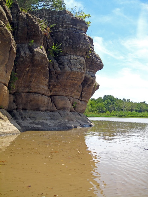
Our first stop was Blue Spring, about 6/10 of a mile downriver from Powder Mill. Blue Spring is a beautiful spring of an impossibly blue color. There are many springs called Blue Spring in Missouri, but this one embodies the name the most successfully. You could stare down into the never-ending, cerulean depth of crystal clear water for ages. Blue Spring can also be reached by two trailheads; one off of Hwy. 110 and another from Powder Mill campground. There is a small lookout at the top of the bluff overlooking the spring hole and branch. We spent some time there marveling at the water and then headed back to the boats. DW and I swam in the confluence of the spring and the river, yelping when we swam through the icy spring waters that were mixing into the river channel. This weekend wasn’t as chilly as the previous weekend on the Eleven Point and the Current’s waters aren’t quite as cold, so we were able to do more swimming.

We stopped at a gravel bar just around the corner from Robert’s Field access. There was a large bluff across from the gravel bar, which is almost always a good fishing spot. While scanning the bluff I spotted a Bald Eagle watching us from a tree high up on the bluff. He hung out for a little bit and then flew up the valley. We all fished the hole under the bluff for a while. Jake and DW both caught some nice small mouth bass. They were legal length to keep, but just barely, so they released the fish back into the river.

Current River

A big Northern Water snake suns on a rock

Current River

Current River

Current River

Our campsite the first night

After we finished fishing that spot it was getting late in the afternoon and time to start looking for a campsite. We probably paddled 3-4 miles until we found the perfect site. Nine times out of ten we find a suitable site, wake up the next morning and paddle, and there will be a much better site just around the bend from where we camped. Not this time though. This was a large, flat gravel bar directly across from a bluff. We unpacked the boats and set up camp in the fading light. This time we brought a small charcoal grill to cook dinner on. After dinner we built a small camp fire in the grill. It was nice to have a fire and it kept us just warm enough. We spent most of the evening stargazing. Since Jake and Aaron both live in cities, they don’t get to see the stars very often. Still, the sky over the Current is not as spectacular as it is over the Eleven Point. Eventually we put out the fire and all headed to bed. The next morning DW and I woke up and the entire river valley was full of thick fog. We couldn’t see much past the tent. Within minutes the sun started to rise and a gentle breeze blew the fog away entirely. Soon Aaron and Jake awoke and we started repacking and ate breakfast. Aaron got to experience pooping in the woods for the first time. Congratulations to him! It sure beats a port-a-potty on the second day of a music festival.

Current River

DW mans the gear barge

Current River

Blue Heron

Current River

Current River

Aaron & DW jumping off a rock

Current River

Current River

Our second day was spent mostly fishing and swimming. We finally got to use the snorkel I bought back in July. It’s been so long since I’ve used a snorkel, it was difficult to remember to breathe while my face was underwater! We all caught some more fish, but nothing worth keeping. Lots of tiny smallmouth bass, some sunfish and goggle eye. We didn’t see hardly any paddlers until we neared Van Buren. There aren’t any outfitters between Two Rivers and Van Buren and anyone we did see was camping overnight like us. We passed Waymeyer access around 5pm and started to look for a gravel bar to camp. Many of the good spots were already taken by other paddlers or people with motor boats. I found one gravel bar that was pretty flat, but the rocks were kind of big. DW thought we could do better, so we kept going. Soon we were nearly in Van Buren, where most of the river bank is private property. I couldn’t believe how many new houses had been built since we last paddled this stretch 5 or 6 years ago. The recession definitely hasn’t hurt the vacation home industry in Van Buren! Eventually we found an island with a flat gravel bar that was secluded from the houses on one side. We took it because there wasn’t going to be anything better! Everyone unpacked their gear and set up camp. As DW and I set up our tent one of the poles cracked. Duct tape to the rescue! We ordered new poles from Eureka when we got home. Eureka has good customer service and will usually replace broken parts, but you have to send the whole tent back to them and it can take almost a month to complete the process. We just don’t have time for that. There is too much camping in the next month to wait!

As we were settling in to camp and getting ready for dinner someone upriver started setting off large fireworks. We walked to the edge of the gravel bar to get a better view. It was a nice show. I guess the fire ban doesn’t apply to them! I think those were the only fireworks I’ve seen this year, since most of the 4th of July festivities were cancelled due to drought. After the show ended we cooked up some bratwurst and chicken and ate dinner around the fire. DW, Jake and Aaron shotgunned some beer for some nostalgic male bonding. It was hilarious to watch. Eventually Aaron and I wandered off to our tents and Jake stayed up to watch DW fall asleep in his chair. The next morning we cooked up some eggs and bacon, packed the boats and drifted downriver toward Van Buren.

Current River

The bridge at Van Buren

Current River

Current River

Jake, DW & Aaron

There are some really deep holes full of big fish right before you get to town. We spent a lot of time fishing there, though we didn’t catch any of those big fish. Suddenly the bright, sunny day clouded over and thunder boomed in the distance. We started to paddle a little more earnestly. By the time we reached the bridge it had started to sprinkle. It rained just enough to make me put on my rain jacket and kayak skirt. Of course as soon as I did, it stopped raining. The larger thunder storms passed to the North of us. DW and I have never floated past Van Buren before. Taking out at Big Spring is only an extra 5 miles downriver. As soon as we got out of town the landscape reverted to wilderness pretty quickly. It is a very pretty section of river and we’re thinking about doing a trip from Van Buren to Doniphan sometime in the future.

Current River

Old bridge pillars at Big Spring Park

Current River

Jake, Aaron, Me & DW at Big Spring take out

Current River, Big Spring

Big Spring

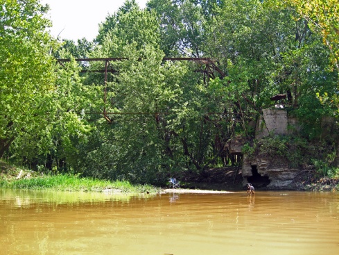
We spent the rest of the trip lazily paddling and fishing. We saw 3 deer crashing through the underbrush on a gravel bar. Soon the take out appeared before us and our trip was at an end. We packed all the gear into the Subaru as the rain started to fall just a little bit. After we were packed we drove to check out the spring the park is named for. Big Spring is one of the 3 largest springs in the United States and one of the largest in the world. It is also the second largest tributary into the Current River. It is a beautiful spot to visit and a really nice park as well. After we checked it out the rain stopped again and we headed over to Stray Dog Pizza & BBQ in Van Buren for a late lunch. We ordered a pulled pork pizza with pineapple and jalapenos as well as some wings and a “dog pile”. A dog pile contains pinto beans, pulled pork, jalapenos and cheese sauce piled on top of corn chips. Delicious! It was a lot of food but we managed to eat all of it, somehow. DW and I didn’t eat dinner that night since we were so full! We drove back to Powder Mill to drop Jake at his truck and then headed home. We had to get up at 4:30 the next morning to get Aaron on his early morning flight back to New York. It was a great trip with great friends. We all had a blast and can’t wait to do it again!

Critter Count: Turtles, Blue Herons, Green Herons, 1 Bald Eagle, 1 Northern Water Snake, 3 Deer.

Float #47 & 48: Eleven Point River

27 Aug

Greer to Riverton

Eleven Point River
Oregon County, Missouri
Saturday, August 11 and Sunday, August 12
19 miles

Every year we try to float the Eleven Point around my birthday in mid-August. This year it just happened to coincide with the annual Perseid meteor shower and a St. Louis Adventure Group float trip. Rather than do the trip on our own we decided to join the SLAG overnight trip, meet some new people and watch the meteors with them. DW took the canoe this time and I took my kayak. This way we were able to pack as much gear as we wanted without worrying about space or weight. Taking the canoe also gives DW some practice on maneuvering the “gear barge” all by himself, a task he thoroughly enjoys. We also took our fishing gear for the first time in a long time. I had never fished from a kayak before, so it took a little adjusting, but was a lot of fun in the end.

DW and I headed down to Hufstedler’s campground on Friday afternoon. We set up a minimal camp, ate dinner and met some SLAGers. We hit the tent early and woke up early to get a good start on the weekend’s float. Hufstedler’s shuttled everyone and their gear to Greer access. DW and I paddled upriver to the bridge and did some fishing while everyone else geared up and pushed off.

Eleven Point River, Greer Access

Greer Access

Eleven Point River

Eleven Point River, Mary Decker Shoals

Mary Decker Shoals

Eleven Point River, Turner Spring

DW tests the waters at Turner Spring

Eleven Point River, Turner Spring

Turner Spring

Eleven Point River

The Eleven Point is a spring-fed river and the waters are some of the coldest in the state. Unfortunately, the weather was a bit chilly with highs in the upper 70s, which made swimming uncomfortable. We usually don’t have a problem with it being too cool in August, but we really can’t complain too loudly since the temperatures have been so hot most of the summer. I managed to go swimming once or twice and DW dunked himself in Turner Spring; waters that are too cold for me even in the hottest weather.

We spent a lot of time fishing and drifted along at the back of the group, catching up to them as they made gravel bar stops. I almost caught a rainbow trout, but it jumped off the hook right as I was about to reel it all the way in.

We passed Whitten access, which is scheduled to be closed for renovations for the remainder of the season. The park service is adding updated campsites and improvements. DW took a few dives off of the jumping rock near Whitten. Even though the Eleven Point still has plenty of water in it, we did notice it was down about a foot. Even the springs were a little lower than normal.

There was one tricky spot above Whitten where a tree trunk leans out into a narrow river channel. The combination of the fast water, tree obstacle and the eddy made for a lot of overturned boats. I made it through just fine as my kayak maneuvers quickly in tight spots. DW made it through also, but nearly missed an important paddle stroke that was the difference between floating through smoothly and capsizing. Luckily, there were some people hanging out on the gravel bar that were helping the capsized boaters.

Eleven Point River

Eleven Point River

DW dives off the jumping rock near Whitten

Eleven Point River

Eleven Point River

Shoving off Sunday morning

Sometime in the early evening we all pulled up to a large gravel bar to camp. There were 33 people in the SLAG group, so finding a large gravel bar was a blessing. The Eleven Point is known for its lack of large gravel bars. There are several float camps tucked into the woods, but none of them are very large. Luckily, this gravel bar had a great view of the sky to watch the meteors. We saw so many huge shooting stars that looked like comets themselves! We didn’t even stay awake for the peak of the shower, which is after midnight and mostly in the early, early morning hours. Since there is a fire ban throughout Missouri due to the drought, we didn’t have a roaring fire to keep us warm. The only way to fight off the night chill was to burrow into a sleeping bag in our cozy backpacking tent. The next morning we all broke camp, packed up our gear and headed toward Riverton. Even though DW and I were some of the first boats on the water we were soon at the back of the pack again. Fishing while floating will do that.

Eleven Point River

Eleven Point River

Eleven Point River, Boze Mill

Boze Mill Spring

Eleven Point River, Boze Mill Spring

Boze Mill Spring

Eleven Point River

A Green Heron hunts for lunch

Eleven Point River

Snaaaakke!

Eleven Point River

Eleven Point River, Riverton

Hwy. 160 Bridge at Riverton

Sunday was much more cloudy and slightly cooler than Saturday. We got a few sprinkles in the morning, but not enough to get us wet. We decided to fish and not paddle until Boze Mill, which was about 4 miles down from our campsite. DW caught some small mouth bass, but nothing big enough to keep. We stopped at Boze Mill and took a couple dips in the freezing spring water. It was really cold, as usual, and the lack of sun did not help. However, swimming at Boze Mill is something we do every time we go to the Eleven Point and it cannot be skipped because of chilly weather! After Boze Mill we went through Halls Ferry rapid. The water level was down enough to not be tricky and I think everyone made it through just fine. After that we floated and fished the rest of the way to Riverton. We saw a beaver along the banks and a huge snake swimming on top of the water. It may have been a rattlesnake, as we’ve seen one or two on this river before, but I can’t be sure. After getting to Riverton we loaded our gear and headed to Van Buren for pizza and wings at Stray Dog BBQ. The next weekend we did another overnight trip on the Current River that was equally as much fun. Too bad all my weekends can’t be spent this way!
Critter Count: Blue Herons, Green Herons, Kingfishers, Bats, 1 Beaver, 1 Water Moccasin, 1 huge unidentified snake

Bonus Prizes: 2 cooking skillets left on a gravel bar

Float #46: Meramec River

10 Aug

Pacific Palisades to Allenton

Meramec River
Franklin County, Missouri
Sunday, August 5
6 miles

This was a short float we did with the St. Louis Adventure Group as part of the Wyman Center Poker Paddle charity benefit. In exchange for a registration fee we received 5 playing cards along different stops on the river. At the end the best poker hands received prizes. We didn’t get anything as all our hands were no good. That’s usually my outcome when I play poker, but at least I got to enjoy a nice float along with it.

I’ve floated this section of the river before, but it’s been a few years. Although it is much closer to St. Louis than most of our Meramec floats, it is still a beautiful section of river. The preceding night this area received a downpour of rain that brought the river up a couple feet and deposited a lot of sediment in the water. Our rivers have been very low all summer with the drought, so the rain was a blessing. Unfortunately the water wasn’t as pretty as usual and there was quite a bit of flood debris.

Our friend Mike joined us for this float. He was quite generous in covering our registration fee for the charity event. DW picks up so much trash on the Meramec that Mike was happy to give something back. Mike owns a nice piece of property along the Meramec just downstream from the River Round access. We met him on the river a few years ago in December when we were doing a cabin fever float. We picked Mike up at his house and drove to the Allenton river access to register and hop a shuttle to the put in at Pacific Palisades.

Meramec River

Pacific Palisades access

Meramec River

Great Egret

Meramec River

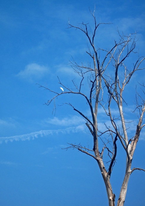
We paddled upriver a little bit so as to not get stuck in the large crowd of boaters getting on the river. A flying carp jumped out of the water and almost hit Mike’s kayak! You will see many flying carp on the big muddy rivers such as the Mississippi. I guess because the Meramec was so muddy they were jumping here too. We also saw a flying catfish later on in the float. When the river gets stirred up, catfish get frisky. After paddling up some more I noticed a large white bird flying by. He landed in a dead tree, giving me time to identify him as a Great Egret. I don’t see too many Egrets on the rivers I float; maybe one every few years.

Meramec River

Meramec River

Classic Car Bank

Meramec River

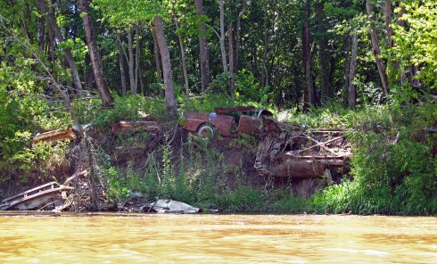
After we adventured upriver for a bit, we turned and went downstream to catch up with the rest of the group. DW, Mike and I picked up a lot of trash. I’m sure some portion of it had been washed down in the rain, but there was a large variety of trash. Usually the majority is beer cans, but here it seemed to be styrofoam containers and a fair amount of glass. We also passed a river bank that had been stabilized with old cars. Thankfully this method of river stabilization is no longer implemented!

Meramec River

Meramec River

Meramec River

Although the day was cooler than previous weeks, it was still pretty muggy. Though the water was murky and smelled of good clean mud, I couldn’t help but swim. It was refreshing none the less. Hey, some people would probably pay a spa good money to bathe in cool waters fortified with natural soils and minerals!

The scenery along this stretch of river is pretty and there aren’t many people or buildings within sight. This section is at the very edge of the Ozark Mountain foothills. So there are some low bluffs and rolling hills. With the drought we’ve had all summer some of the trees have started to turn colors already. A good month and a half ahead of usual. Others have given up entirely. This is a really bad year for tree growth!

Meramec River

Meramec River

Meramec River

Allenton access

We took our time on the float and didn’t paddle much until the end. I think we were some of the last people to finish! At the Allenton access we were treated to some barbecue, loaded up our boats and headed back home. It was a nice float for a Sunday and a fun group of people. Coming up next is an overnight trip on the Eleven Point which should be a lot of fun!

Critter Count: Blue Herons, 1 Great Egret, Flying Fish

Float #45: Gasconade River

3 Aug

Hwy. 17 to Riddle Bridge

Gasconade River
Pulaski County, Missouri
Saturday, July 21
14 miles

This year I wanted to get out and float some rivers that I haven’t floated in a long time, or ever. One of these rivers is the Gasconade. The Gasconade is the longest river entirely contained within the state of Missouri. It twists and turns for 250 miles from the south central area of the state to the Missouri River. It is a relatively slow and lazy river without much gradient, but it has excellent fishing and plenty of cool, clear water. Fun fact; the early French named this river the Gasconade because the Indians who lived along its banks were very boastful of their exploits. Gascon is french for a boaster or braggart.

The section of the Gasconade that we floated is about a half hour west of Rolla. Our friend Richard, who lives in the area, offered to run shuttle for us. Very generous of him to do so, as he had recently had shoulder surgery and was unable to float with us. We met up with him at Riddle bridge, loaded our boats on his truck and drove to the Hwy. 17 bridge. Hwy. 17 crosses the Gasconade at the confluence with Roubidoux Creek. Roubidoux Creek has a lot of springs feeding into it and the water was very, very cold. It looks like a good float for spring when there is more water.

Gasconade River

Roubidoux Creek at Hwy. 17 access

Gasconade River

Hwy. 17 bridge

Gasconade River

Gasconade River

Gasconade River

One thing we noticed right away was the amount of algae in this river. There is more algae growing in the Gasconade than I am used to on floating rivers. Perhaps it has to do with all the cattle on the river banks? There were a lot of cattle near or in the river and a lot of old tires partially buried in the banks and river bottom. There is no way to haul out tires with a kayak, or I’m sure DW would have tried. Even with the algae the water is still very clear and cool.

Gasconade River

Gasconade River

Gasconade River

Gasconade River

This section of the Gasconade reminds me of a slower version of the Meramec. It was an easy float, although we did have to paddle a lot to get downstream. These 14 miles could take forever if you don’t paddle! It seems like a good river to paddle up, since you would go about the same speed either way and there weren’t too many fast spots that would be hard to paddle up. We didn’t see any other boats, just one party barge of rafts and tubes and some locals fishing and hanging out on the banks. We didn’t see much wildlife outside of the normal birds, but I did see a lot of fish. I chased one huge fish with my boat for a little bit. I don’t know what kind it was, but it was almost 4 feet long and spotted. It wasn’t a gar, though I saw plenty of those too.

Gasconade River

Gasconade River

Gasconade River

A spring bubbles from the hillside

Gasconade River

Gasconade River

Riddle Bridge

We finished up the float in early evening, loaded our gear and headed for home. There weren’t many landmarks or points of interest on this float, but it was enjoyable and not at all crowded on a hot Saturday. I look forward to doing more floats on this river and its many tributaries in the area.

Critter Count: Blue Herons, Osprey, Ducks, Cows, Big Scary Fish

Float #44: Current River

3 Aug

Powder Mill to Two Rivers (and Back)

Current River
Shannon County, Missouri
Wednesday, July 4
13 miles

We desperately wanted to go floating in some really cold water on the 4th. All the rivers close to our house are pretty warm in midsummer, so we decided to drive 2 hours south to the Current. None of our floating crew wanted to float that day and we didn’t want to spend money on a shuttle, so we opted to paddle upriver and back. We’ve been doing a lot of upriver paddling on the Meramec near our house. It’s not too difficult if you are a strong paddler and can read water fairly well. Of course there are always some spots that are too shallow and fast to paddle up. A rope tied to the front handle of the kayak makes it easy to pull the boat behind you and walk up the riffles. Then you just have to navigate the uneven footing and slippery rocks and hope you don’t slip and fall!

We left our house around 7:30 and drove to Powder Mill access on the middle Current. Powder Mill is also known as Owl’s Bend. This bend of the river has long been a favorite with owls. Camping here overnight can be noisy with all the hooting. We unloaded and started paddling around 10. As soon as we passed the Hwy. 106 bridge we had to stop for a swim. The first plunge into the cold, clear water made the drive totally worth it!

Current River

Powder Mill access

Current River

There were hundreds of fat dragonflies flying all over the place. You can see one of them in the left corner of the first photo. They don’t bother us much, but there’s always one hitching a ride on the nose of my boat. Anything is better than horseflies! Thankfully those haven’t been too bad this year.

The middle Current has lots of long, slow pools which are easy to paddle up. The shallow and fast parts however, are much longer and a little faster than on the Meramec. This was definitely harder work to get upriver, but still very enjoyable. The river was surprisingly quiet for a holiday. I don’t think there are any outfitters between Two Rivers and Van Buren, so that cuts down on the amount of people. We saw a couple of canoes and some people barbecuing on the gravel bars, but we mostly had the river to ourselves.

Current River

Current River

We didn’t quite make it all the way to Two Rivers. About a mile away we started to get a little tired and it was almost 3pm, so we were running out of time. We turned around and floated back to Powder Mill, stopping to swim several times along the way. There were a lot of snakes swimming across the water. We rarely got close enough to properly identify them. I also saw a couple of deer along the bank and the usual assortment of water birds.

Current River

Hwy. 106 Bridge at Powder Mill

We arrived back at Powder Mill around 5:30, packed up and drove the two hours back home. It was one of the best 4th of July holidays I’ve had. And that cold water was really nice! The next day at work, my arms felt like wet noodles from all the paddling, but it was a lot of fun.

Critter Count: Blue Herons, Green Herons, Ducks, Snakes, 2 Deer

Float #43: Meramec River

1 Aug

Bruns’ Bridge to Chouteau Claim

Meramec River
Franklin County, Missouri
Saturday, June 30
9 miles

The Saturday before the 4th of July we met up with Saint Louis Adventure Group for a quick float on the Meramec. Saint Louis Adventure Group (SLAG) is a Meetup.com group of outdoor enthusiasts in the St. Louis area. They do many floating, hiking and bicycling events throughout the year. It’s a great group to join if you’re looking to get into an outdoor sport or find other people to enjoy it with. SLAG was floating from River Round access to Chouteau Claim, a 5 or 6 mile float. Since DW and I prefer something a little longer, we put in at Bruns’ Bridge and met up with the group at River Round.

Meramec River

Meramec River

Alex & Charlie

Meramec River

DW and Hedwig

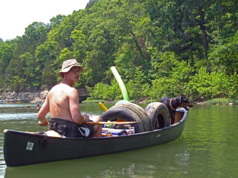
Last time we did this float we noticed many old tires along the river bank. Since this was a short, lazy float close to home DW took the canoe so he could pick up all the tires. I took my kayak and our Doberman, Hedwig, took the front of the canoe. She is not a natural water dog, but she warmed up to it after we put her doggie life jacket on. I think she enjoyed all the extra attention! It was a really hot day so the group made a lot of stops to swim, even though the water wasn’t very cold. The Meramec really warms up in the summer heat, especially with the 100˚+ temps we’ve been having most of this season.

Meramec River

Meramec River

DW and his trash barge

Meramec River

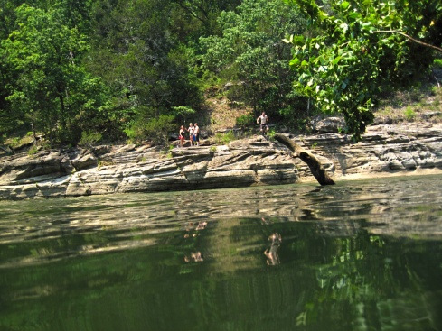
DW at the jumping bluff

We stopped a while at the jumping bluff and then again toward the end for some more swimming. We all got off the river around 4:30 or 5:00 and all the St. Louis people started their drive back to the city and we headed home. It was a nice way to spend the day and we will definitely be doing more floats with SLAG in the future.