Archive | September, 2011

Float #23: Huzzah Creek

22 Sep

Hwy. 8 Bridge to Onondaga State Park

Huzzah Creek
Crawford County, Missouri
Saturday, September 17
9 Miles

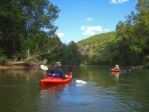
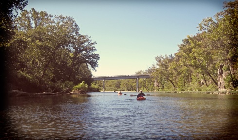
After 4 weekends of floating in a row we took a week off and then I immediately experienced float withdrawal. I am not looking forward to winter when the dark, cold, kayakless days stretch on forever. To remedy my withdrawal I planned a trip on the Huzzah Creek for what was supposed to be a sunny, warm Saturday. However upon waking up Saturday it was discovered the day was not to be sunny at all or warm, but rather wet and chilly. I used to dislike rainy float trips, but since I’ve owned a kayak (especially one with a decent waterproof skirt) I kinda like them as long as it isn’t pouring. We met our friends Charlie, Alex, Scott and Megan at the Hwy. 8 bridge access. This access is directly across the water from Huzzah Valley Resort. There is limited parking under the bridge if you want free access, or you can pay Huzzah Valley to park at their place. We got started on the river around 11am in a slight drizzle. Right before we pushed off DW and I saw a bald eagle fly up the valley. Outside of some herons and an osprey that was pretty much the only wildlife we saw all day.

huzzah river, hwy 8 access

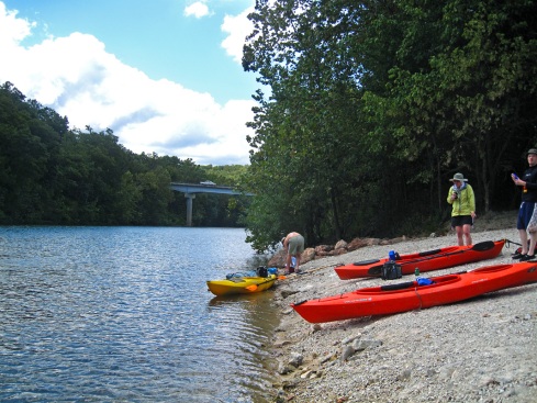
Access under the Hwy. 8 bridge

huzzah river

huzzah river

huzzah river

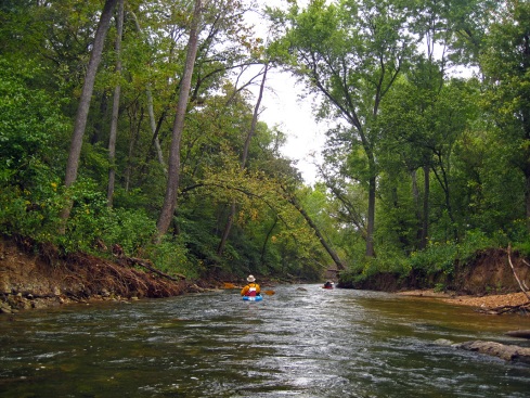
If you’ve ever been on the Huzzah in summer you know how crowded it can be. The Huzzah is a popular float destination for the party crowd. During a busy weekend the creek will be bumper to bumper with rafts full of  drunk, loud people. The banks will be full of trash and the water will be a murky, dirty mix of beer and piss. Sounds lovely doesn’t it? However, in the spring, fall and winter the Huzzah is quiet and secluded and water is crystal clear. The water can be low during dry spells in the fall and winter since the Huzzah has a small watershed, but you can usually float from Hwy. 8 down to the Meramec. A few bends down from the access we came across two canoes cleaning up the river. They had already collected a couple of tires and lots of cans. It’s always nice to see someone else doing a river cleanup on their own! Especially since we can’t haul out tires on our kayaks. A couple miles into the float the creek narrows and runs under a canopy of trees and arching trunks spanning the water. It is the prettiest section of the entire creek.

huzzah river

huzzah river

huzzah river

huzzah river

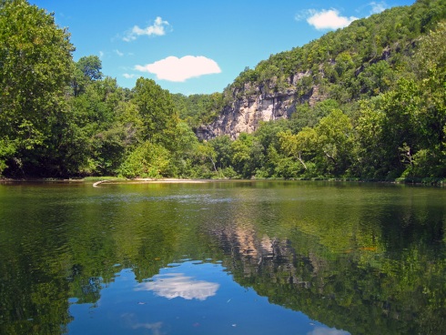
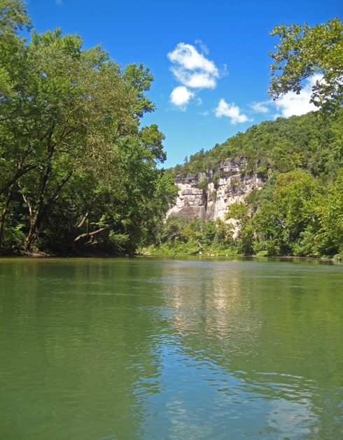
After the narrow section the creek widens quite a bit and we came upon a nice bluff bordered by a slough full of lily pads. Soon after that the Courtois Creek comes into the Huzzah. The Courtois (pronounced coat-a-way) is an even smaller creek that is great to float in the spring. It has lots of tight turns and obstacles near the top that makes for a fun float in a kayak. The Courtois was pretty low when we passed. Charlie paddled up a little bit and was scraping in low water right away. After the confluence it started to rain again. I bought a neoprene skirt for my boat back in the spring, but I never had a reason to use it until this float. It’s really tight to fit on the boat. I needed help to get it stretched around the back, but I’m sure it will loosen up if I use it more often. The neoprene really made a difference and repelled water like a champ. We soon came upon Huzzah Conservation Area, which stretches between the Meramec and Huzzah. There is a low-water bridge and an access on the right side. Usually you have to portage around the bridge or float over if the water is up. This time we were able float under easily because the water was so low.

huzzah river

huzzah river, courtois river

Courtois & Huzzah confluence

huzzah river, huzzah conservation area

Low water bridge at Huzzah Conservation Area

huzzah river

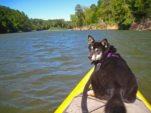
huzzah river, shiba inu

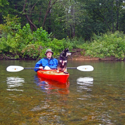
Portrait of a man and his dog

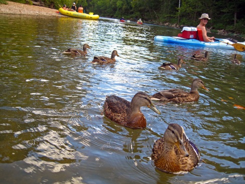
Not long after the conservation area the Huzzah flows into the Meramec. Remember those ducks that held us up for food last float trip? Well they were here again. We were surrounded and yelled at by a troupe of greedy ducks on the Meramec. Alex gave right in and fed Charlie’s sandwich to them. Poor Charlie had no post-float snacks. Yadi was very interested in the ducks and thought perhaps he should feed them, to himself.

huzzah river

huzzah river, meramec river

Huzzah & Meramec confluence

meramec river

meramec river, ducks

Alex & Charlie feed the ducks

meramec river

After we got away from the ducks the rain started to drizzle again and the take out came into view. We loaded up our boats and ran shuttle, then everyone headed back to my house (which is only an hour away) for a big spaghetti dinner. Next week DW and I are going on a four day trip and will be doing some overnight camping on the river. This will be the first time we’ve done an overnight in our kayaks. I hope everything fits!

Critter Count: 1 Bald Eagle, Blue Herons, Green Herons, Osprey

Bonus Prize: 1 Bass River Resort coozie

Float #22: Meramec River

12 Sep

Campbell Bridge to Sappington Bridge

Meramec River
Crawford County, Missouri
Monday, September 5
10 miles

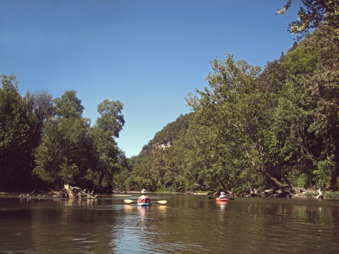
Labor Day is one of those holidays I usually stay away from the rivers due to large crowds and rowdy people. Scott & Megan wanted to do a short float on Monday and since we had no plans and it was a beautiful day we said why not. Most people were headed home by Monday so the river wasn’t crowded. We decided to do a section of the Meramec none of us had done before and we didn’t regret it. This section of the river was lined with tall bluffs and forested banks. The water was very clear and cold. Campbell bridge is right next to Blue Springs Ranch, a campground by the river, in Bourbon, MO. You have to carry your boat down a steep, gravely hill to get to the water and hope you don’t slide all the way in! We put on the river around 11 and the wind had started to pick up by then. The forecast for the day called for winds up to 20 mph, which is a little inconvenient when paddling into the wind. I wouldn’t want to be in a canoe on a windy day; a kayak is a little easier to push down the river. It was actually easier to paddle upstream instead of into the wind, so I’m sure it slowed us down a bit. The upside is to get anywhere on a windy day you have to paddle, which makes it an exercise float and we made good time anyway.

campbell bridge, meramec river

Campbell Bridge access

ducks, meramec river

Ducks chasing the boats

meramec river, kayaking

Just down from the put-in we caught up with a group in a raft on the shore. They had been feeding some bread crumbs to a group of ducks. The ducks saw us approach and assumed we had food too. They chased us around for a few hundred feet. I haven’t ever seen wild ducks get that close to a boat, but I guess these guys had been living the campground life all summer and were used to humans. Other than the ducks, wildlife was kinda sparse on this trip. I think it’s the first trip all year we didn’t see any blue herons.

meramec river bluffs

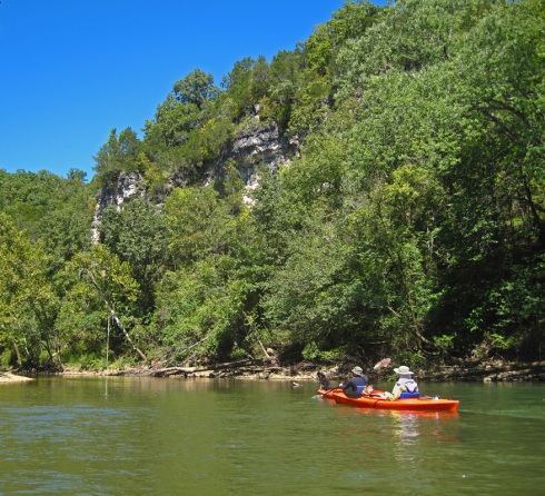
Bluff along the river

meramec river bluff

meramec river, bluff, birds

Vultures circle the bluffs

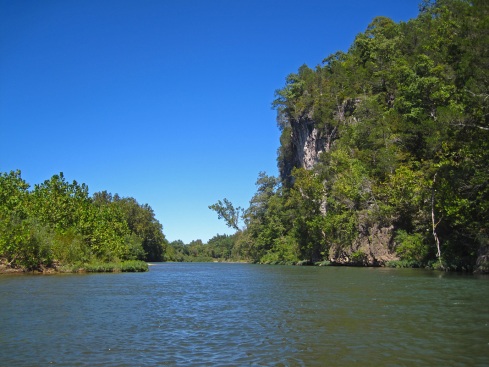
We passed Blue Springs campground and access on the left side of the river, as well as the spring branch the campground is named for. Blue Springs isn’t very big and the water coming in didn’t look much different from a creek, but it was very cold. We soon came upon some picturesque bluffs and it seemed every other bend had a tall bluff on one side. I had never seen so many bluffs in a single float on the Meramec. At the first bluff a group of vultures were circling and flying in and out of a small opening near the top.

meramec river turtle

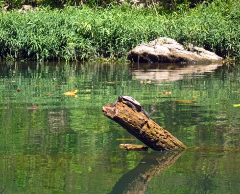
Turtle sunning on a log

meramec river, kayaking

meramec river, kayaking

There were quite a few turtles sunning themselves on logs and rocks. We saw a large softshell as well as the common river turtles. As the day heated up we shed our outer layers and contemplated a swim. The temperature was in the upper 70s and breezy. I decided to take the plunge anyway. I think it was warmer in the water than out in the wind! I used some turtle logic and sunned myself dry on the bank and it wasn’t so cold after that.

Scott and I switched boats halfway through the trip. He wanted to try mine out. Scott & Megan both have a Wilderness Systems Pamlico kayak. The Pamlico is quick and maneuverable, but the cockpit is very open leaving lots of room for water to get in the boat and there wasn’t much storage area. It reminded me a lot of my old red Perception, a good, affordable beginner boat with no extra frills. Scott’s dog Yadi enjoyed the extra room on the top of my kayak. He could even lay down on the front! When we switched our boats back Yadi stayed in mine for while. He surprised me when he could see the faster water coming and dove into the cockpit before we hit the ripples. A dog that reads water, who knew!

meramec river bluffs

shiba inu, meramec river, kayaking

Yadi test rides my kayak

sappington bridge, meramec river

Sappington Bridge access

We took off the river in late afternoon at Sappington bridge, a conservation access on Hwy D near Sullivan, MO. We then drove the long back roads to shuttle our stuff back to Scott’s car at the put-in and parted ways. DW and I routed a new back way home from Bourbon. It was a perfect end to the holiday weekend.

Critter Count: Ducks, Kingfishers, Turtles

Float #21: Eleven Point River

2 Sep

Greer to Riverton

Eleven Point River
Oregon County, Missouri
Saturday, August 27
19 miles

We finally made it to the Eleven Point this past weekend. This is our favorite river in the state and we usually go at least twice a year, but this year has been hectic and the summer almost slipped by without a visit. We headed down to Hufstedler’s campground on Friday afternoon. Hufstedler’s is in Riverton, which is a tiny village with a river access, camp store, campground and outfitter. We have been frequenting Hufstedler’s for many years and they always treat us well. The campground usually has free firewood which is a big bonus!

We set up camp, cooked dinner, had a couple drinks and hit the hay so we could wake up early and get on the river. With only one day available to float we wanted to do as many miles as possible and decided to do the 19 miles from Greer to Riverton. This trip covers most of the highlights of the Eleven Point and is a reasonable day float if you get started early. Going on a trip with just the two of us makes everything more flexible; we can adhere to our own schedule, start as early as we want and we never have to wait for anyone but ourselves. We awoke at 7am and our boats were in the water at Greer access by 9:30. The largest spring on the Eleven Point is Greer Spring and it joins the river just above the access. The water here is very cold! Greer Spring has a .9 mile hiking trail descending 250 ft. in elevation. The trailhead is off Hwy. 19 across from the campground and river. It’s well worth the trip if you’ve never been before.

greer access eleven point river

Early morning on the river

Mary Decker Shoals

Looking upriver at Mary Decker Shoals

As we paddled down from Greer a thick fog was still burning off the water. Everything looks more mysterious with the fog. We can hear the water rushing over a rapid ahead but can’t see anything more than 10 feet in front of the boat. Within a half hour the fog cleared and the sun rose above the ridgeline. We spotted a bunch of wildlife within the first few hours. A raccoon was digging for food along the bank. We floated right up to him and he just stared back at us and continued his morning chores. It was nice to see a raccoon in its natural habitat instead of eating the birdseed off my porch. Later we saw a bald eagle flying downriver and a bat flying upriver after a long night out. We soon floated past Mary Decker Shoals which consists of a line of rocks in the middle of the river. In low water Mary Decker can be a real scraper. Fortunately the water was up a bit for August and we glided right through. The outfitters tend to make a big deal of Mary Decker Shoals, always telling people to watch out for it, but unless it’s flood water or you’re a really bad canoeist it’s a pretty easy obstacle.

turner mill, eleven point river

Turner Mill Wheel

eleven point river

Turner Mill Spring

The mouth of Turner Mill Spring

DW immerses himself in the spring

Rock wall at Turner Mill

Shortly after the shoals is Turner Mill access. There are boat ramps on both sides of the river here. Turner Mill South was recently renovated to include an expanded campground and an additional boat ramp. This is a popular put-in for floating to Riverton. Turner Mill North is less popular as it is harder to get to by road, but it’s easy to paddle across the river from the south access to walk up to the spring. Turner Spring comes gushing out of a small opening in the bluff and tumbles down to the river. The water here is much colder than the river. Standing in it for a few minutes numbs your legs; it’s so cold it hurts! A grist and sawmill was in operation here from the late 1890s through the 1920s. All that’s left of it are a large mill-wheel and a rock wall. There was once a small community here by the name of Surprise, which had a post office and a school. The town didn’t last long and no one was left by the 1940s.

eleven point river

eleven point river

DW dives off the jumping rock

eleven point river

After Turner there are several float camps on the left side of the river. The Eleven Point does not have many gravel bars suitable for camping so the National Forest Service provides some small, primitive campgrounds through the middle section the river. About 6 miles from Turner is Whitten access. This access has a primitive campground and boat ramp. But be warned, Whitten is a popular local hangout and they tend to dominate the campground every weekend. Unless you’re from “around here” or well versed in Ozark culture you won’t be invited to the party. Halfway between Turner and Whitten a large rock with a small tree growing on it juts out of the river on the left side. We call this the jumping rock and we always stop so DW and whoever else can jump into the deep water. Our dog Zoe used to  jump off this rock when she was a young pup. Across from the jumping rock is a good gravel bar for camping. The bank is steep but there is plenty of flat ground at the top. When camping along the Eleven Point be sure to armadillo-proof your campsite. Those bastards are everywhere. They wait until dark falls and come shuffling up to your site, making a bunch of noise and scaring the crap out of you. Armadillo’s can’t see well and are oblivious to humans until they get right up to you. They are harmless but annoying when you’re trying to sleep and they’re scratching up the forest floor looking for food.

Boze spring, eleven point river

Boze Spring

boze spring, eleven point river

Underwater at Boze Spring

boze spring, eleven point river

Mill Dam at Boze Spring

boze spring, eleven point river

Boze spring from the dam

Near the end of the trip is our favorite spot on the river, Boze spring. This is another spring that ran a grist mill in the late 1800s. The dam and some parts are scattered at the end of the spring branch. There is also a float camp here, which is one of the most popular on the river. Boze spring is rumored to be over 80 ft. deep before it becomes too narrow for humans to dive further. The water is crystal clear with turquoise blue depths and is numbingly cold. Boze is a popular swimming hole and good people watching too. It’s always fun to sit and watch first-timers yelp when they dive into the cold spring. You can see where the water boils up in the middle of the hole, which is where the coldest of the cold water lies. Back in the 80s there used to be a tree with a rope swing over the boil. Unfortunately the tree fell into the spring a long time ago, but everyone still likes to talk about it. When we stopped by for a swim there were a couple local farmers sitting by the spring watching people swim and drinking apricot brandy. We each took a swig when offered and concluded that apricot brandy really hits the spot after a dip in the cold water.

DW surfs Halls Bay Chute

Hwy. 160 Bridge at Riverton

Around the next bend from Boze is the best rapid on the whole river, Halls Bay Chute. Keep to the left for this one as the right is studded with sleepers (rocks lurking just below the surface that will tip you). Halls Bay is a good class II rapid and can sometimes get up to class III in high water. It’s also a good spot to stop and watch people tip over. There is always someone camped out on the gravel bar for this reason. Since the water was up a bit the rocks were covered and the run was easy, even for canoes. There is a rope hanging from a tree at the beginning of the drop. Hit it straight at the rope or to the left for the best waves. After Halls Bay it is an easy 3 miles to the take out at Riverton. We were off the river around 6:30, sooner than we expected. We packed up our gear and went back to camp to eat dinner and pass out in front of the fire. The next morning we broke camp and went back to Boze spring to swim again. Swimming at Boze the morning we leave has become tradition for us. It’s hard to get in that water first thing in the morning, but I never regret it. Dive in and repeat until your body becomes a tingling numbness and your mind achieves a zen-like state. I am convinced that if you could jump into this spring every morning of your life you would live forever. Although there isn’t much difference between the Eleven Point and heaven itself.

Critter Count: Blue Herons, Green Herons, Kingfishers, Ducks, Turtles, 1 Bald Eagle, 1 Raccoon, 1 Bat