Archive | May, 2013

Float #71 – 72: Current River

31 May

Pulltite to Two Rivers

F71_Current

Current River
Shannon County, Missouri
Saturday, May 18 – Sunday, May 19
26 miles

Our first overnight float trip of this year was a fun St. Louis Adventure Group trip on the Current River. We met up with the group at Two Rivers campground on Friday night, sat around the fire, ate some food and got to know everyone. On Saturday morning we loaded our boats and gear on the bus and headed up to Pulltite access. It has been a long time since I’ve ridden a school bus on curvy roads and my stomach was not amused! Once we arrived I felt better and we all loaded up our boats for the trip. Most people had kayaks. DW took the canoe so we could pack more gear and overnight in comfort. A roomy tent and an air mattress are 4 star accommodations on the river bank! The day started out cloudy, but not too chilly. This is the first float of the year that has been warm enough for a swimsuit and dry enough to put the rain gear away.

Current River

Pulltite access

Current River

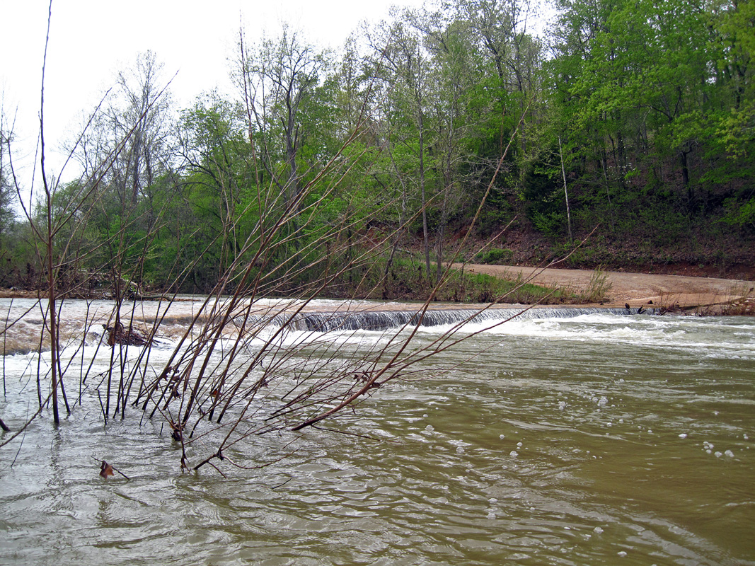
Pulltite spring branch

Current River

DW takes a cold dip

Current River

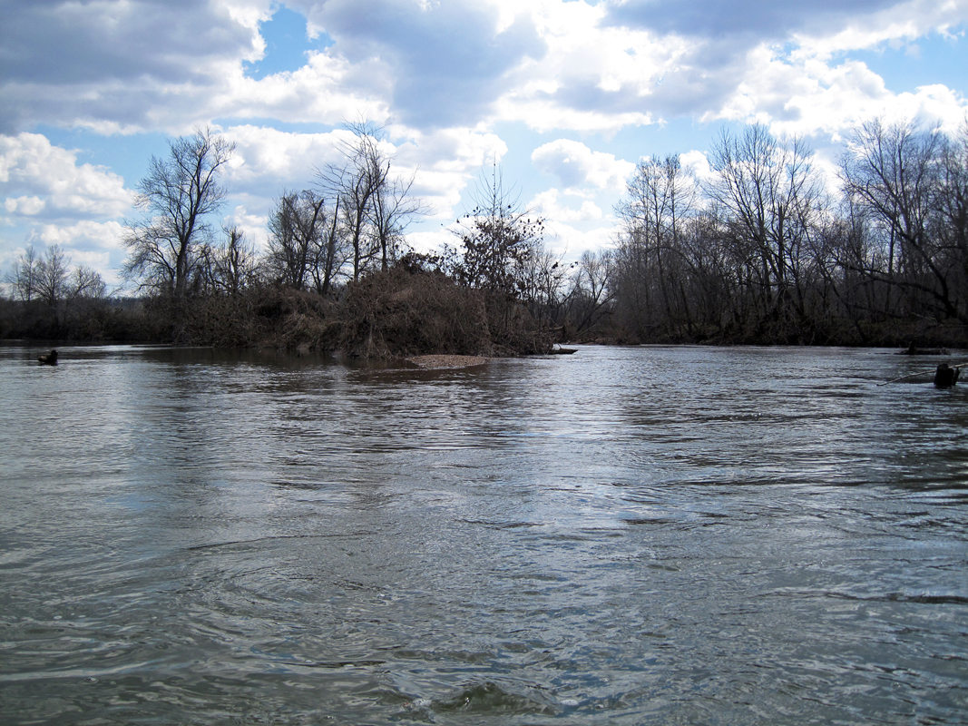
Right around the bend from Pulltite access is Pulltite spring. If you park your boat at the mouth of the spring branch there is a trail leading up to the spring and an old cabin. We’ve been here so many times that we didn’t stop on this trip, but there are photos of the spring in some of my previous Current River posts. Just downstream of Pulltite spring is Fire Hydrant spring, a small spring that gushes out of the rocks. It is easily missed if you’re not looking for it. DW and I quickly fell behind the group, as we usually do. We were busy fishing and lazing along instead of paddling. We only caught up to the group once at lunch and then again at camp. I like to spend as much of the day as possible on the river and if we paddle we’re likely to finish the whole trip in one day!
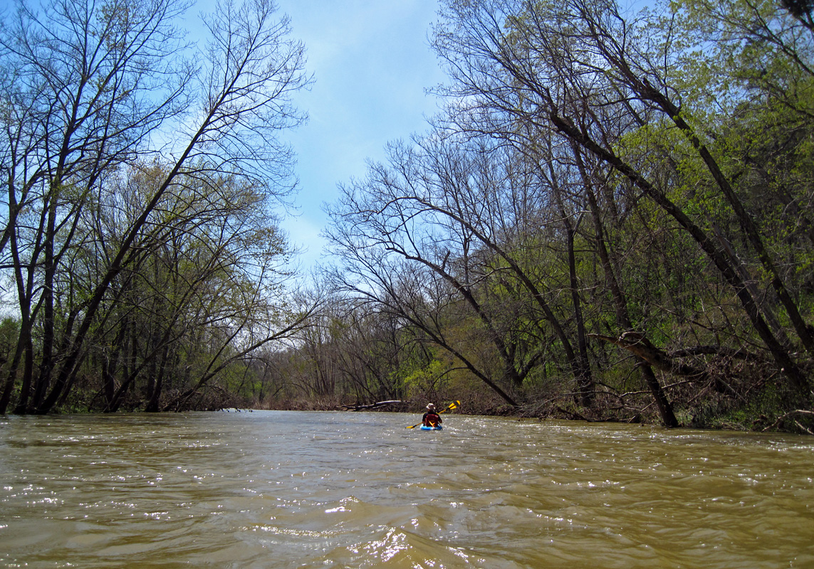
Current River

Current River

Sinking Creek

Current River

Hwy. 19 bridge at Round Spring

Current River

Just above Round Spring is Sinking Creek. This is a popular area for swimming and has a large gravel bar. There is a small campground here too, but it gets very busy on the weekends. Soon we passed Round Spring, a large campground, spring and river access. The water is a little higher than I’ve seen in recent years and one of the boat launch areas was mostly submerged. Once you get past Round Spring the horsepower limit for john boats goes from 25 to 40, so there are a lot more john boats on this section of river. After Round Spring the group started looking for campsites. There are a number of gravel bars past Round Spring, but not many of them are big enough for a large group of people. The gravel bars are also starting to get overgrown with willow and sycamore trees. Not a bad thing for erosion control, but it makes finding a clear spot for camping a little more difficult. We finally caught up to the group on a patchy gravel bar they were considering for camp. A john boater told us there was a much nicer, larger gravel bar about a mile downriver. Half of us decided to paddle on to find it. The other half had already unloaded some of their gear and decided to stay there for the night. We did find the bigger gravel bar. It was across from a long, low bluff and fairly clear of vegetation, much nicer than the original spot!

Current River

Current River

Our campsite

Current River

Current River

Current River

We spent an enjoyable evening around the campfire, swapping stories and cooking dinner. DW and I had beef burritos; so tasty after a day on the water! One couple brought their black lab, Daisy, along in their canoe. We enjoyed hanging out with her as it brought back good memories of canoe trips with our black lab, Zoe, who passed away last summer. Some people were anxious about raccoons coming into camp and messing with stuff. I’ve never encountered a raccoon while camping on a gravel bar, only in campgrounds. However, we did tell them to watch out for armadillos. Not because they are dangerous, just because they are very loud and will startle you. If it sounds like there is a bear coming out of the woods, it is most likely an armadillo poking around.

The next morning dawned cloudy yet again, but it was nice and warm. The fog stayed on the river until nearly 11am. It was good fishing in the morning. DW caught two 10 inch smallmouth and I caught one little one and almost caught a bigger one, but he jumped off the hook.

Current River

Current River

Current River

Current River

Once the fog burned off and the sky cleared the day warmed up quickly. It was warm enough for me to swim and that was really nice! As the day wore on we grew bored with fishing and spent the day drifting downstream, mostly backwards as the wind picked up a bit and spun our boats around. In the afternoon the river got busier as many locals put their john boats on the river after church on Sundays. I was reminded why I usually don’t float the Current in the summer as it only gets more crowded into August.

Current River

Current River

Jacks Fork confluence
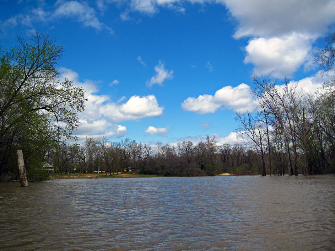
Current River

Two Rivers

Around 4pm we rounded the bend and saw Two Rivers campground in the distance. Our trip was over too soon! Since DW and I usually spend at least 3 days on overnight trips it was a little disappointing to be finished already. Overall it was an excellent float with a lot of fun people and a great kick-off to the summer season.

Critter Count: Herons, Kingfishers, turtles, 2 Softshell turtles, 2 mink

Float #70: Huzzah Creek

17 May

Red Bluff to Hwy. 8

F70_Huzzah

Huzzah Creek
Crawford County, Missouri
Saturday, May 4
15 miles

Another weekend, another flooded creek float! The weather pattern has been almost the same every week this spring. It rains hard on Thursday or Friday and then there is a window of dry weather on the weekend. Thus every weekend the creeks and rivers are raging. This trip we caught the Huzzah on its way down. It was moving pretty quickly and the water was nice and choppy, but the flood debris was already flushed out.

We met up with our friends Charlie and Scott at Huzzah Valley campground and ran shuttle up to Red Bluff Recreation Area. Red Bluff doesn’t have an official boat access, but there are several spots to access the creek from gravel bars or the campground. We didn’t get on the river until nearly 2pm, but the water was moving so quickly that it was a breeze to finish the trip before dusk. We ended up paddling for less than three hours start to finish.

Huzzah Creek

Red Bluff access

Huzzah Creek

Red Bluff

Huzzah Creek

Low water bridge

F70_04

Once again the weather was cool with highs in the 50s. There was a light sprinkle from time to time, but nothing to really get us wet. There are three low water bridges to cross on this float. We had to portage the first two, but were able to float over the bridge at Hwy. Z. Several of us got pretty wet floating over the Hwy. Z bridge. It was a very splashy drop over the lip! This Huzzah trip was almost the exact opposite of the last time we did this creek. This time the water was fast, there were no trees or log jams to portage and we didn’t get soaking wet from the rain.

F70_05

Railroad bridge

Railroad bridge

The low water bridge past the RR bridge

The low water bridge past the RR bridge

Huzzah Creek

I think I have worn my life jacket more this spring than I have in the last 5 years collectively. Of course, you should always wear your life jacket if you aren’t experienced on the water, or you aren’t a strong swimmer (children under 13 are required by state law to wear one). I wear mine anytime the water is faster than I can swim to shore. I like when I have to wear my life jacket because I know it’s going to be a fun ride!

Huzzah Creek

Huzzah Creek

Huzzah Creek

Huzzah Creek

There was one tree the had fallen across the river, but there was just enough water for us to float over the trunk. I don’t think a canoe would have been so lucky. When we stopped for lunch on one of the few gravel bars above water we noticed a Bald Eagle in a tree across from us. He sat there and watched us eat our lunch and was still there when we left. These days it doesn’t feel like a real float trip if we don’t see a Bald Eagle! As we got closer to Hwy. 8 the clouds started to break up a little bit and we saw a patches of blue sky. The spring flowers were out in full force and bright green new leaves coated the trees. This time of year is so beautiful and it only lasts a couple of weeks before the forests are cloaked in summer vegetation.

Huzzah Creek

Huzzah Creek

Huzzah Creek

Hwy. 8 bridge

It seemed we reached Huzzah Valley in no time (and we kinda did). We passed under the bridge and pulled into camp. When we left that morning we could have floated right up to our campsite, but the water had dropped quite a few feet since then and we had to drag our boats up on the bank. It was a great float with good friends. The Huzzah is really fun when the water is moving.

Our next float is an overnight trip on the Current River, the first of the year. It should be lots of fun and maybe the weather will finally be warm and sunny!

Critter Count: 1 Snapping Turtle, Herons, Kingfishers, 1 Bald Eagle

Float #69: Meramec River

2 May

Short Bend to Woodson K. Woods

F69_Meramec

Meramec River
Dent & Crawford Counties, Missouri
Saturday, April 20
25 miles

We were scheduled to float a lower section of the Meramec on this Saturday, but a large amount of rain the previous week caused the river to rise out of its banks. Since that trip got cancelled we decided to go all the way upriver where the water level was already falling. We’ve been wanting to do this trip on the upper Meramec for a while, but you need good water levels to float it. At 25 miles we also needed a good full day to paddle. DW and I drove down to our takeout at Woodson K. Woods Conservation Area near Steelville Saturday morning and met up with our friend Mark who ran our shuttle. It was a bit of a drive to get all the way upriver, but very scenic. We arrived at the Hwy. 19 bridge, where the Short Bend access is located and were on the water around 11am.

Meramec River

Short Bend access

Meramec River

Lake spillway

Meramec River

Meramec River

Low water bridge

Even though the water was brown and the air a little chilly, the sun was shining and the countryside was in full spring glory. The water was quick and a little choppy, which is the way we prefer it! We paddled steadily with no breaks, not knowing how long it would take us to go the 25 miles. There are several low water bridge to cross on this float and they are all on the float map (unlike that Huzzah trip). We cam to the first one fairly quickly, but the water was not high enough to float over. Most of the bridges on this float had to be portaged, but I think the water would have been a little scary if it was high enough to float over!

Meramec River

Hwy. M bridge

Meramec River

Meramec River

Meramec River

Approaching the dam

Meramec River

DW runs the dam

13 miles into the trip is a low dam that usually needs to be portaged. There is a tall stone wall jutting out into the water right before the dam. DW went to the right and was able to float over the dam. I went to the left and floated over, but I scraped a little bit on the descent. The dam was a 2 or 3 foot drop when we went over it. It was fun, but not too exciting. A little more water would have been good for this obstacle. After we passed the dam we realized we were making really good time and decided to stop paddling constantly. The water was probably running 3-4 mph on its own and if we kept paddling we’d be done too early.

Meramec River

Fishermen at low water bridge

Meramec River

The laziest flood log

Meramec River

Meramec River

Shortly after the dam we came to another low water bridge where some men were fishing. One of them caught a nice sized bass right as we pulled up. Another fisherman remarked to DW, “Isn’t the water too high to be floating?” DW quipped back that the water was a little too low for his liking since he had to portage all these bridges. A little later we floated past a large log that was riding the current downstream. We thought it must be the laziest flood log, since all its buddies had gone downstream a couple of days earlier. There was a lot of flood debris in the trees bordering the river. Leaves and sticks covered everything a few feet above us. At one point the banks were covered with loose hay. I guess someone’s hay got swept away and deposited along the river for a couple miles. It made everything look a little creepy, like Halloween tinsel!

Meramec River

Meramec River

Meramec River

Eventually we came to the low water bridge at Hwy. U, which is the uppermost place we have floated previous to this trip. That bridge was underwater so we were able to float over it. Everything down from here looked familiar, but the water was much, much lower last time we floated it. We took these last few miles pretty easy and just let the current carry us. We were going to finish this float a couple hours earlier than expected. Unfortunately it was way too cold to swim and most of the gravel bars were underwater, so there was no reason to stop and dawdle.

Meramec River

Meramec River

Meramec River

Hwy. 8 bridge

All too soon, we heard the sound of traffic and knew the bridge was up ahead and our trip was over. We finished it in less than 6 hours without paddling very hard. When you’re floating a new section of river you never really know what you will encounter or how fast the water is. These 25 miles went by quicker and easier than the 20 we did on the Huzzah a few weeks ago, probably because we didn’t have nearly as many portages! It was a great trip and a lot of fun.

Critter Count: Blue Herons, Ducks, Green Herons, Hawks, Turtles

Float #68: Little & Big Indian Creeks

2 May

Little Indian Creek Conservation Area to Red Horse

F68_IndianCreeks

Little & Big Indian Creeks
Franklin County, Missouri
Friday, April 19
5 miles

DW and I were both off work on this Friday and we wanted to go for a short float trip. Unfortunately, we had a lot of rain the previous day and all the rivers were high and rising. So we decided to float the creeks near our house instead. There are several creeks that lead into the Meramec river within a few miles of our house. These creeks are not floatable very often. When there is enough water, it is usually in the middle of a rainstorm, after dark, or we’re at work. This particular day the sun was out and we took a quick road trip to scout the water. The temperatures were in the mid forties, but the water looked just about perfect; plenty of flow but nothing too tricky. We headed back to the house and loaded our boats, ran shuttle and put in on Little Indian Creek at the conservation area. There is a low water bridge here, but the water was flowing over it so we walked our boats up a little bit, put in and ran the bridge. Great fun!

Little Indian Creek

Little Indian Creek

An old bridge

Little Indian Creek

Once we floated out of the conservation area we kept our eyes peeled for fences or other obstructions. We have never floated this creek past where we put in and it is private land on both sides, so you never know what you’re going to run into. Luckily, no one had any fences across the water and there were no major obstructions. The creek is small and twisty with plenty of small riffles and tight turns taking us past cattle fields and forests.

Little Indian Creek

Little Indian Creek

Portaging to Big Indian Creek

Little Indian Creek

Confluence of the creeks

Big Indian Creek

Little Indian Creek

Soon we came to our next low water bridge at Old Hope Church road. The water was not flowing over this bridge, so we had to portage. It is very close to Big Indian Creek, so rather than getting back in our boats to float a few more feet, we just dragged them over the gravel to Big Indian Creek. Big Indian Creek is much wider and usually has a bit more water than Little Indian Creek. On this particular day it felt just like we were floating the upper Courtois or Huzzah. The spring trees were blooming on the hillsides and the grass was emerald green. Soon the sun came out in full force and I had to get rid of a few layers of clothing.

Little Indian Creek

Old Hwy. K bridge

Little Indian Creek

The creek slows approaching the Meramec

Meramec River

High water on the Meramec

Big Indian Creek flows underneath Old Hwy. K bridge before running into the Meramec. As soon as we approached the bridge the water slowed down a lot, backing up from the high water on the Meramec. As we paddled into the confluence the water was spread over the banks and through the trees on the banks. We paddled around for a bit through the trees, which is always a fun experience. We tried to go upriver a little bit, but there wasn’t much room on the side of the river to paddle up. The water was pretty swift all the way across.

Meramec River

Floating through the trees

Meramec River

Meramec River

Red Horse access

Once we paddled into the main channel we rode the current down to Red Horse access. A short trip that usually takes 5 or 10 minutes was over in 2 or 3! We floated right up to the boat ramp and congratulated ourselves on a successful first run of the creeks. It may be a long time before conditions are this perfect to float it again.

Critter Count: Herons, Ducks, Hawks

Float #67: Mineral Fork

2 May

Hwy. 47 to Merrill HorseF67_MineralFork

Mineral Fork Creek
Washington County, Missouri
Sunday, March 31
12 miles

DW wrote this guest post. I was sick the day this float trip occurred, so he went by himself with our friends Charlie and Alex.

Continuing with a weekend of creek floating, our friends Charlie and Alex joined me for a leisure Sunday creek float on the Mineral Fork. The Mineral Fork only has one location, Kingston Access, for accessing the creek that is on public property with parking available, so we worked out another arrangement to access the creek at the Highway 47 Bridge. All along the road are no parking signs. This access had a steep carry for the boats while the distance to carry was minimal. This access is used by numerous locals during the summer as a swimming and fishing location. I presume they either only use the easement by the bridge like we did or have permission from Kingston Ranch who owns numerous thousands of acres in northeastern Washington County. The area surrounding the bridge is very well-marked where you will cross the line and start trespassing out of the easement area.

Hwy. 47 bridge

Hwy. 47 bridge

Bluffs along the creek

Bluffs along the creek

F67_03

We put on the river around 11:30am and begin our journey down another new section of water. Previously, we have used Kingston Access to float down to the Big River. This section of the Mineral Fork is quite pretty with a couple impressive bluffs, the beautiful countryside, and the wonderful weather as we traveled downstream. Shortly into our journey we ran into some other folks from the area who also used the Highway 47 bridge access to start their fishing trip courtesy of a friend dropping them off at the put in. Like us, they were surprised to see other kayakers out floating. My memories of this creek are that of fallen trees and a few portages and this trip contained several downed trees that forced some portaging. As is the case so often, just a little bit more water and we would have been able to avoid the portages.

Alex ducks a tree branch

Alex ducks a tree branch

Charlie & Alex portage

Charlie & Alex portage

To the river left side of the bridge that typically creates a portage was a cool spill way that made for a fun little rapid to shoot. This was the first time I’ve been able to run this little rapid and as happens often, I found myself paddling backup to run it again!

Charlie portages a low water bridge

Charlie portages a low water bridge

F67_07

Alex drops into the rapid

Alex drops into the rapid

Charlie's action shot

Charlie’s action shot

After tackling the last of the portages, it wasn’t long before we entered the confluence of the Big River. It’s a good thing I took pictures as my floating partners completely missed the confluence! Fortunately the take out wasn’t upstream as has happened to me before, so we just paddled on down to Merrill Horse Access. One thing that we did notice at the Highway H bridge, which is just upstream from the Merrill Horse Access, were all these orange globes and what looked like owls. The owls had some type of electronic call on them. The best we could figure is the fake owl and orange globes were some type of deterrent for the swallows that typically frequent the bridge for nesting.

Confluence of Mineral Fork and Big River

Confluence of Mineral Fork and Big River

Hwy. H bridge

Hwy. H bridge

It was great to get to go farther up the Mineral Fork and cover an additional 2.3 new river miles. Overall, quite a good way to cap and excellent weekend of creek floating!